 |
| Despite ceasefires, no weapons have been used at the disputed Sino-Indian border |
China has built new structures near the border. Recent images from June 22 show China has built new structures near the location of a Himalayan border. New Chinese bunkers, tents, and storage units that weren't previously there in earlier within the month.
A fatal clash at the India-China border in the Ladakh area has claimed the lives of 20 Indian and 43 Chinese soldiers on 15 June 2020. Foreign ministers of both the countries have held telephone talks over the deadly border clash, agreeing to "cool down" the tensions. India accuses the "violent face-off" is an attempt by China to "unilaterally change the status quo" on the Galwan Valley frontier in Indian administered Ladakh. China, in turn, accuses the Indian army of "provoking and attacking Chinese personnel, resulting in serious physical confrontation". In this article, we will know the reason for the disuse of weapons since 1975 at the Sino - Indian border.
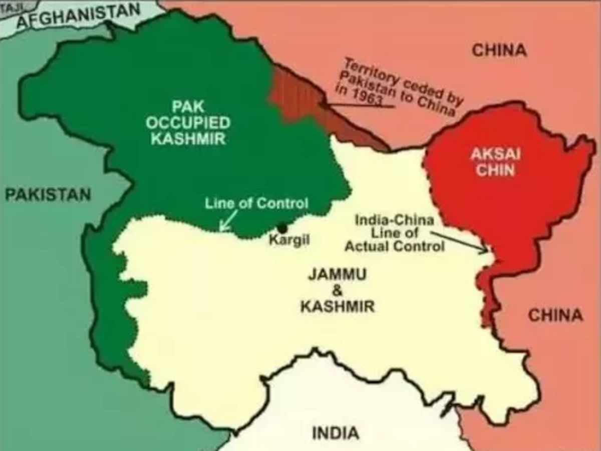 |
| India's northern borders are vulnerable with one side Pakistan and on the other side China |
HISTORY
At the early stages of the 19th century, the Empire of Russia was longing for a warm water port because of the reason that much of the ports in the Russian Empire became frozen during the winter season. Russia thought of getting the warm water ports in Hindustan. During this time India was under the control of the British and so Russia threatened the British for getting a warm water port, since the Russians were sounding stronger than the British, the British thought of taking advantage of the Geographical locations by not allowing the Russians to enter the Indian subcontinent and so introduced a forward defensive line in the northern region, to halt the Russian propel well before the Indian subcontinent. This made Afghanistan and Tibet into buffer states as this area was lying between the borders of two powerful empires. However, Russia got a warm water port by winning a great tract of territory from China.
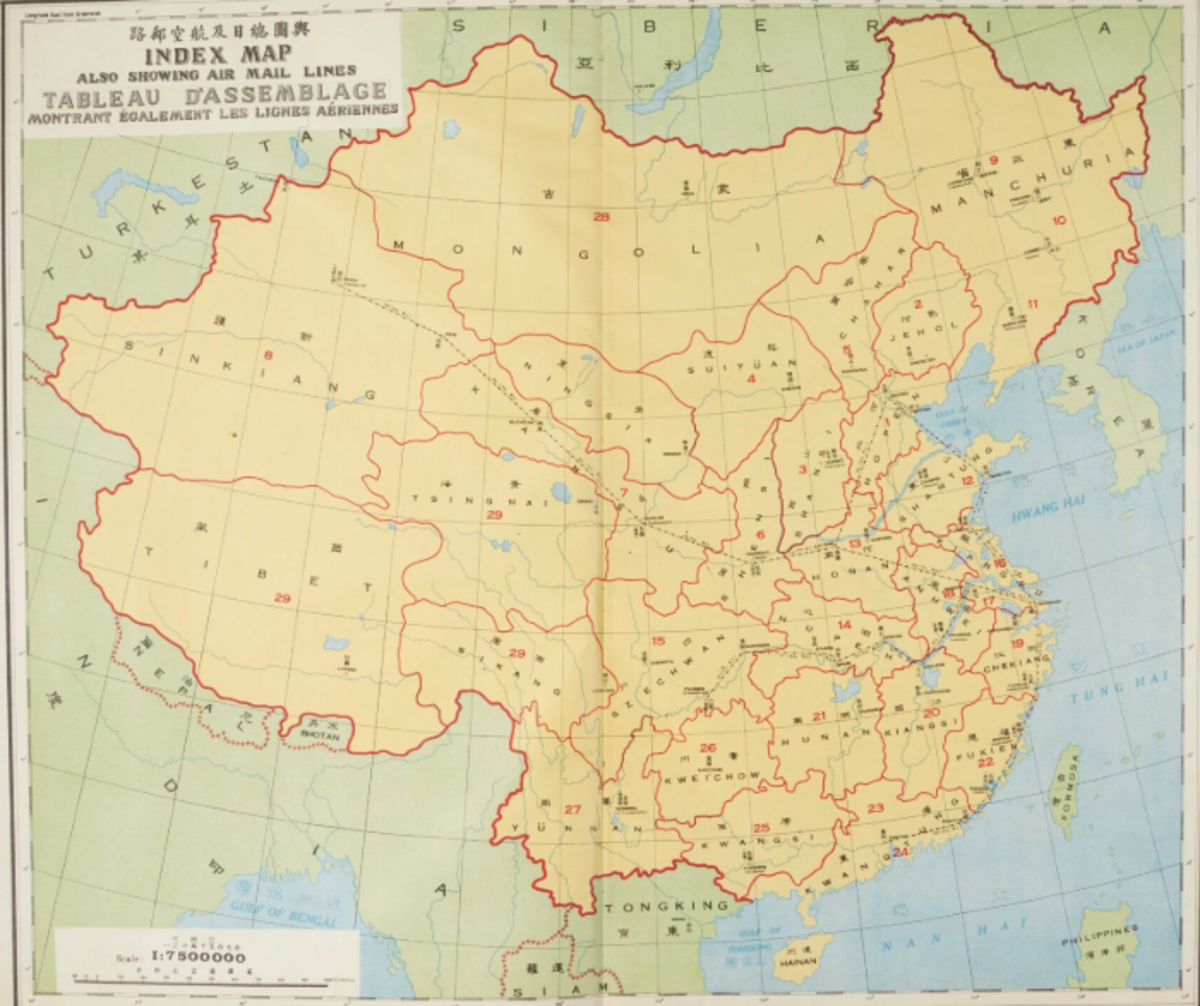 |
| Postal Atlas of China - 1933 Source : https://www.lotsearch.net/lot/china-postal-atlas-1933-21077585 |
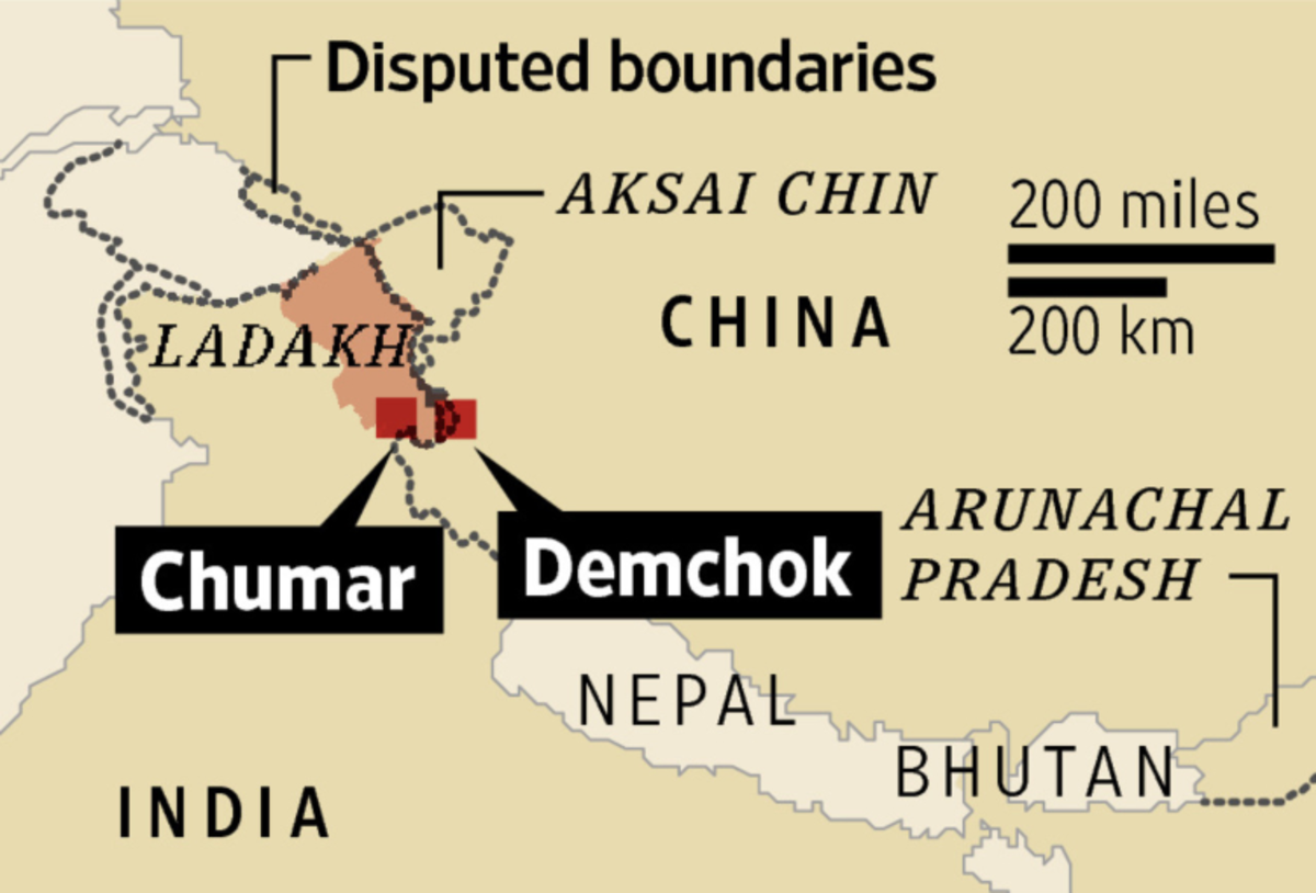 |
| Source : https://www.wsj.com/articles/india-china-border-standoff-high-in-the-mountains-thousands-of-troops-go-toe-to-toe-1414704602 |
In 1947, when India got Independence from the British, India itself set its border without consulting China. Though both the countries had their borders drawn, there was no problem initially. The problem arose when China took control of the sovereign state of Tibet in 1951 by sending thousands of troops to Tibet. Tibet's spiritual leader Dalai Lama escaped from Tibet in 1959 amid a Chinese crackdown. For China, the Dalai Lama's government in exile in India was a constant challenge to its rule in Tibet. For India, it was a symbol of Beijing's refusal to grant real autonomy to Tibet.
The Republic of China's perception of Independent India as a threat to its rule of Tibet became one of the most prominent reasons for the Sino - Indian War. Various conflicts and military incidents between the two countries flared up throughout the summer of 1962. With a three-week ceasefire, the Sino - Indian war lasted till 21 November 1962, after which China unilaterally withdrew from Indian territories. Even today the border dispute between these two countries continues, as India claims the Chinese territory of Aksai Chin and China claims the Indian state of Arunachal Pradesh under its territory.
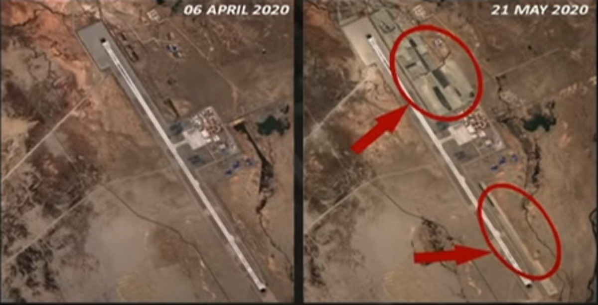 |
| Construction Activity taken place at Ngari Gunsa air base, near the Line of Actual Control. |
Till now, there is no official border agreement signed between the two countries and so the Line of Actual Control (LAC) is considered as the de facto border between these two powerful nations. Since this is not an official border both sides signed a pact that prohibited the use of arms during face-offs at the border. Though arms are not being used at the border, standoffs have been occurring quite often. Usually, stones are thrown on the other side during standoffs.
The current levels of border tension at the LAC are due to the construction activity carried out by China at Ngari Gunsa, an airbase which is situated just a few kilometers from the LAC and the bringing of Chinese fighter jets close to the LAC. This led to the increase in the number of troops also on the Indian side as they feared that China will be able to pose attack on India any time with its fighter jets. India also brought its fighter jets and military weapons near LAC.
Since 1975 no guns have been used at LAC. Since both sides are nuclear-armed, I expect that standoffs will continue between these two countries by neglecting the use of weapons. India's borders in the North are always vulnerable to Pakistan on one side and with China on the other side. We, need to wait to know whether my expectations stand for a long time.
Nice article
ReplyDeleteAwesome Content.
ReplyDeleteGood article
ReplyDeleteGood writing... China is always trying to oppress all the neighbouring countries
ReplyDeleteGood Content
ReplyDeleteVery nice and unique content. Awesome article.
ReplyDeleteNice article
ReplyDeleteNice
ReplyDelete